 Croatia
 Slovenia
 Bosnia and Herzegovina
 Albania
 Montenegro
 Romania
 Bulgaria
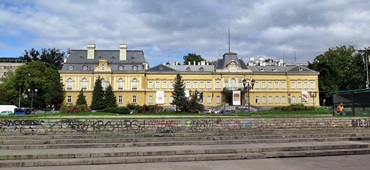
 Serbia
 North Macedonia
 Kosovo
The Best Mountains of Bulgaria and Top Hiking Trails
Bulgaria is a paradise for hikers, but unlike its Alpine or Pyrenean neighbors, it remains blissfully under the radar. The country is home to a surprising diversity of mountain ranges — from the glacier-carved peaks of the Rila and Pirin Mountains to the storybook forests of the Rhodope and Strandzha regions.
Whether you’re a beginner looking for a scenic nature walk or a seasoned trekker seeking high-altitude challenges, Bulgaria’s hiking trails deliver unforgettable experiences without the crowds.
The best part?
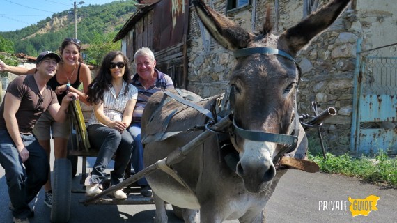
Our colleague Hristo from Private Guide Bulgaria (who is also an experienced hiker) has prepared these trails because they aren’t just pretty, they’re packed with history, culture, and wildlife. Many of them can be combined with eco-lodges, spa stops, or wine tastings, making them ideal for private hiking tours and customized Balkan nature trips.
This guide is for:
- First-time visitors exploring Eastern Europe’s quieter corners;
- Casual hikers seeking waterfalls and well-marked paths;
- Nature lovers chasing views and wildlife;
- Groups or private tour travelers who want a tailored mountain experience.
Best Time to Go Hiking in Bulgaria
| Region | Best Months | Highlights |
|---|---|---|
| Rila & Pirin Mountains | June – October | Glacial lakes, alpine routes |
| Rhodope Mountains | May – October | Forest trails, waterfalls |
| Vitosha & Sofia area | April – November | Accessible weekend hikes |
| Strandzha & East | April – November | Coastal forests, nature parks |
| Stara Planina (Balkan) | June – September | Ridge walks, panoramic views |
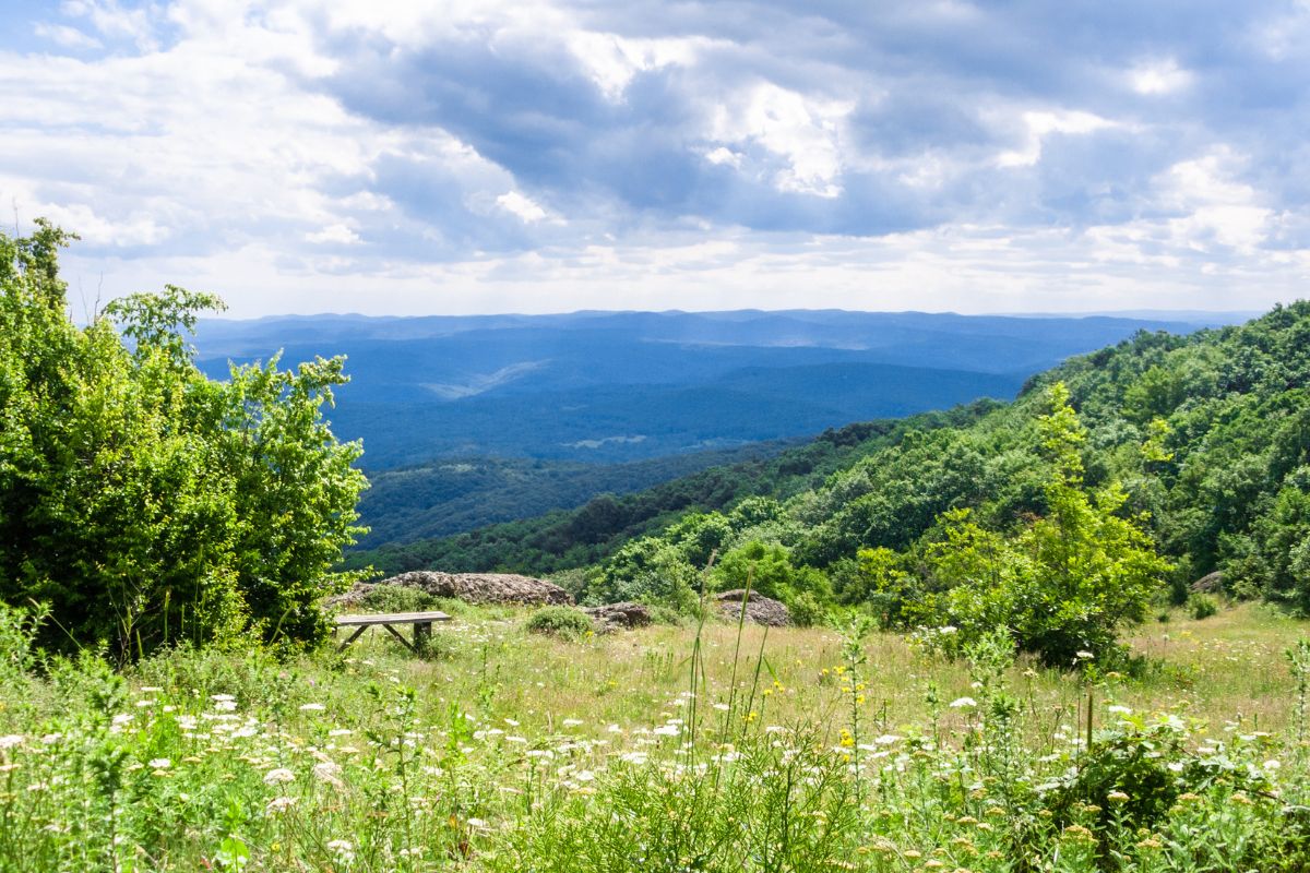
⛰️ Rila Mountains – Where the Balkans Touch the Sky
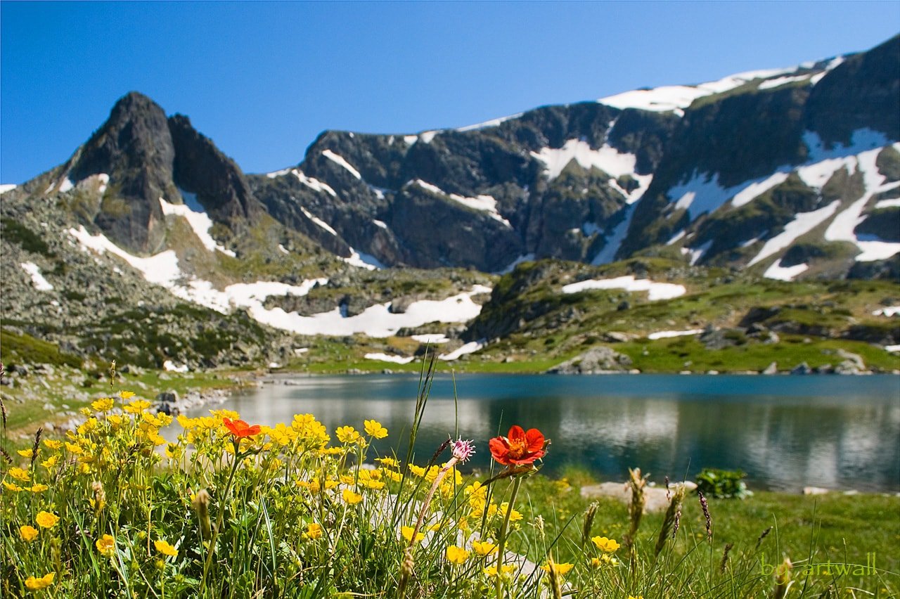
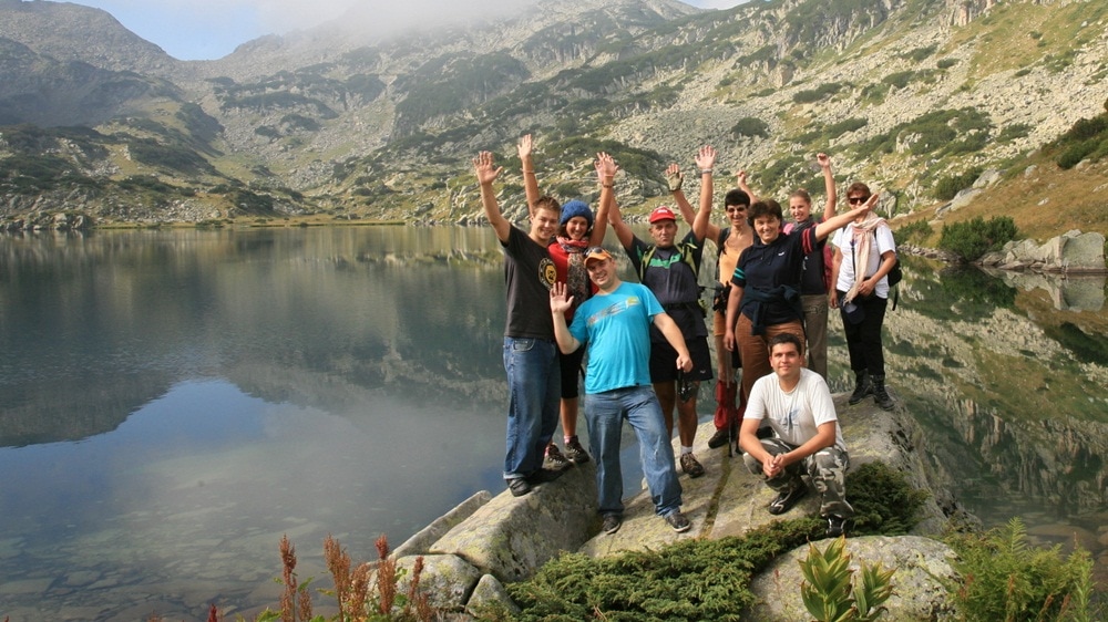
The Rila Mountains are the highest range on the Balkan Peninsula and the most iconic for hikers in Bulgaria. Home to Musala Peak (2,925m), the tallest summit in the Balkans, and the legendary Seven Rila Lakes, this region offers trails for all levels.
Rila is also close to Sofia, making it a top choice for day hikes from the capital, perfect for hiking, trekking, and nature photography.
Seven Rila Lakes Hiking Trail
- Level: Easy
- Distance from Sofia: ~100 km (2 hours drive)
- Route Length: 7.5 km (plus chairlift)
- Elevation Gain: 478 m
- Highest Point: ~2,500 m
- Hiking Time: 3.5 h (+1 h with chairlift)
- Best Months: June – October
- Map: View Trail
This is Bulgaria’s most famous hike — and for good reason. The Seven Rila Lakes are glacial jewels scattered like a necklace across the mountain ridge. This circular trail offers stunning alpine scenery without too much effort, making it perfect for families, photography lovers, and those short on time.
Seven Rila Lakes Loop via Lovna Hut
- Level: Intermediate
- Distance from Sofia: ~100 km (2 hours)
- Route Length: 12 km
- Elevation Gain: 594 m ascent, 1102 m descent
- Hiking Time: 5.5 h (+30 min chairlift)
- Best Months: June – October
- Map: View Trail
Looking for something more immersive? This longer loop takes you beyond the main viewpoints and into quieter corners of the Rila National Park. You’ll pass through alpine meadows and dense pine forests, and descend through scenic ridges toward Lovna Hut — great for nature photographers and fit hikers.
Musala Peak (via Gondola from Borovets)
- Level: Intermediate
- Distance from Sofia: ~80 km (1.5 hours)
- Route Length: 15 km
- Elevation Gain: 618 m
- Hiking Time: 5.5 h (+1 h chairlift)
- Best Months: July – October (gondola opens late June)
- Map: View Trail
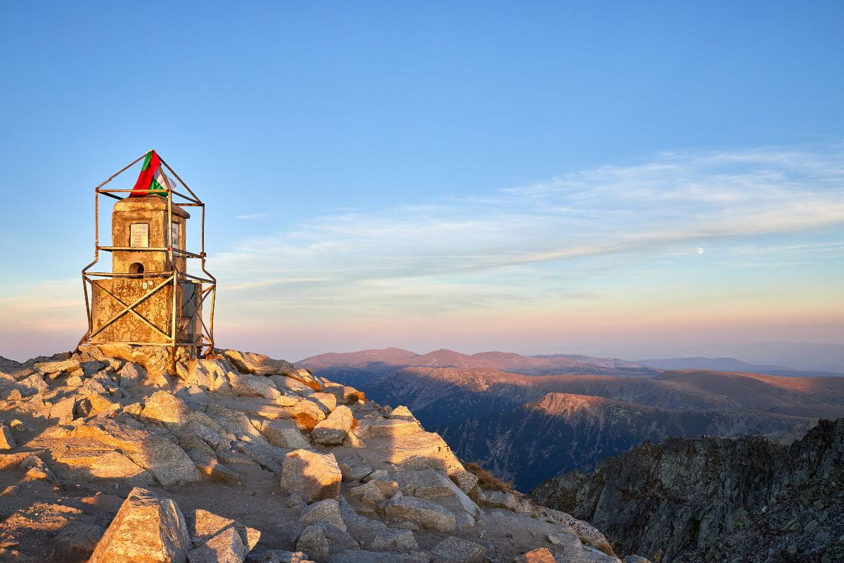
Musala Peak is not only the highest in Bulgaria — it’s the tallest mountain in the Balkans. This trail is surprisingly accessible thanks to a gondola ride from Borovets. The route takes you past glacial lakes and alpine huts, with 360° views stretching into Greece on a clear day. Perfect for adventurous travelers without needing advanced mountaineering skills.
Musala Peak (Full Trail Without Gondola)
- Level: Advanced
- Distance from Sofia: ~80 km (1.5 hours)
- Route Length: 25 km
- Elevation Gain: 1,573 m
- Hiking Time: ~12 hours (full-day hike)
- Best Months: June – October
- Map: View Trail
This is a bucket-list challenge for fit hikers. Starting from Borovets base, you’ll trek the entire way to Musala without shortcuts. It’s a demanding climb, but the alpine flora, peaceful ridgelines, and summit experience make it one of the most rewarding treks in Bulgaria.
⛰️ Pirin Mountains – Rugged Beauty & Glacial Lakes
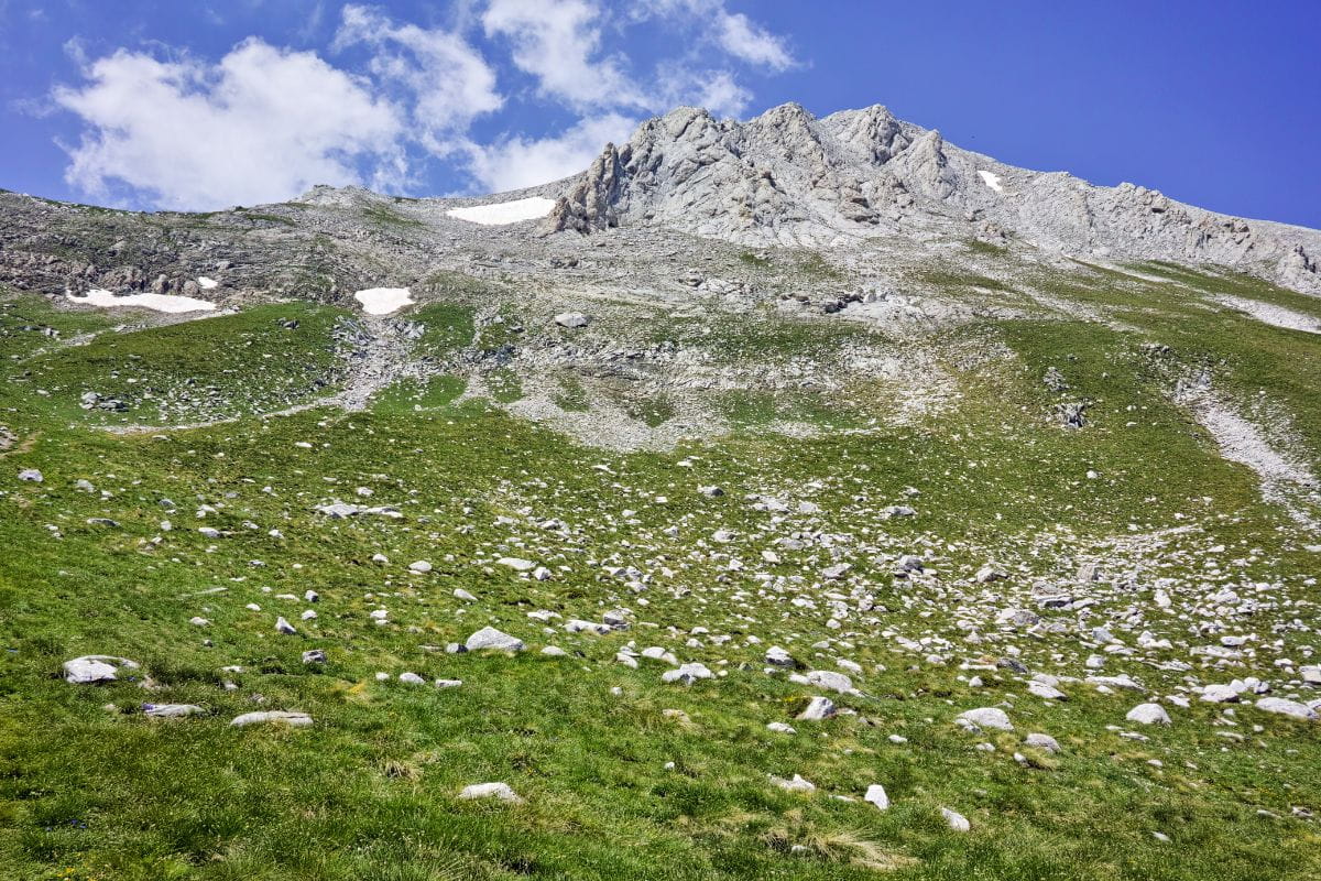
If the Rila Mountains are majestic, the Pirin Mountains are wild. This UNESCO-listed national park offers alpine drama, jagged peaks, and over 180 glacial lakes. With elevations reaching 2,914 meters at Mount Vihren, Pirin is a favorite among experienced hikers and climbers. That said, it also features stunning moderate routes, making it accessible for mixed-level groups and nature lovers.
The Pirin region is best explored from the mountain town of Bansko, which also offers spa hotels, local cuisine, and cultural landmarks — perfect for experienced hikers, rock climbers, and multi-day trekking who’d like to combine hiking with relaxation and sightseeing.
Vihren Hut – Muratovo Lake Trail
- Level: Easy
- Distance from Sofia: ~160 km (2.5–3 hours drive)
- Route Length: 4 km
- Elevation Gain: 258 m
- Hiking Time: ~2 hours
- Best Months: June – October
- Map: View Trail
This short and scenic hike starts at Vihren Hut and winds its way through alpine pastures to the emerald Muratovo Lake. Surrounded by dramatic rocky slopes, the trail is ideal for beginners or anyone seeking a relaxed day in nature with photo-worthy landscapes.
Vihren Peak Trail (Direct Route)
- Level: Intermediate
- Distance from Sofia: ~160 km (2.5–3 hours)
- Route Length: 7 km
- Elevation Gain: 932 m
- Hiking Time: ~6 hours
- Best Months: July – October
- Map: View Trail
This direct trail to Bulgaria’s second-highest peak is steep but manageable. You’ll hike through karst terrain and scramble the final stretch to reach the summit of Vihren (2,914 m): a must-do for fit hikers looking for panoramic views of the Pirin and beyond.
Vihren Peak Loop via Kazanite Shelter
- Level: Intermediate
- Distance from Sofia: ~160 km (2.5–3 hours)
- Route Length: 8 km
- Elevation Gain: 967 m
- Hiking Time: ~6 hours
- Best Months: July – October
- Map: View Trail
This slightly longer version of the Vihren ascent includes a loop through the Kazanite Cirque, adding scenic diversity and a touch of solitude. It’s a favorite among photographers and experienced trekkers who want a more complete alpine experience.
Bezbog Hut – Popovo Lake – Ribni Lakes Loop
- Level: Easy
- Distance from Sofia: ~170 km (2.5–3 hours)
- Route Length: ~9 km
- Elevation Gain: 439 m
- Hiking Time: ~3.5 hours
- Best Months: Late May – October
- Map: View Trail
One of Pirin’s most beautiful easy hikes, this route begins with a chairlift ride to Bezbog Hut, followed by a trail to the Popovo and Ribni Lakes. The reflections of the surrounding granite peaks in the crystal-clear water are breathtaking. Ideal for relaxed hikers and couples looking for a peaceful mountain escape.
E4 European Long-Distance Path (Pirin Section)
- Level: Advanced
- Distance from Sofia: Multi-day itinerary (~8 days for Pirin)
- Length: 104 km
- Elevation Gain: 5,445 m ascent / 5,883 m descent
- Hiking Time: ~8 days (45 hours hiking)
- Best Months: July – October
- Map: View Trail
This portion of the legendary E4 trail takes you deep into the Pirin wilderness, linking huts, glacial valleys, and alpine passes. It’s ideal for experienced hikers or private groups looking for a multi-day adventure. Can be fully guided or custom-planned to include gear transport, local food, and cultural stops.
⛰️ Stara Planina Mountains (The Balkan Range) – Wilderness, Waterfalls & Epic Long Trails
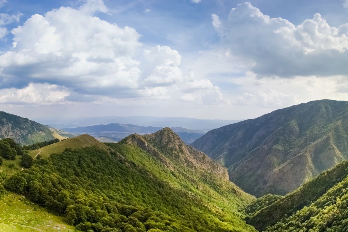
Known locally as Stara Planina and internationally as the Balkan Mountains, this mountain range cuts across Bulgaria from west to east, forming the backbone of the country. The terrain is diverse — think dense forests, grassy ridges, waterfalls, wildflowers, and sweeping panoramas of the Danube Plain to the north, Thracian Valley and the Valley of Roses to the south.
Whether you’re a day hiker based in Sofia or an experienced trekker chasing the full Kom–Emine route, Stara Planina offers some of the most authentic and underrated hiking in Eastern Europe.
E3 Kom–Emine Trail (Entire Traverse)
- Level: Advanced
- Distance from Sofia: Kom Peak (~2.5h drive west of Sofia)
- Route Length: 574 km
- Elevation Gain: 11,875 m ascent / 13,234 m descent
- Highest Point: Botev Peak (2,376 m)
- Hiking Time: 19–20 days (≈192 hours)
- Best Months: June – October
- Map: View Trail
This legendary trail spans the entire Balkan Peninsula ridge, from Kom Peak near the Serbian border to Cape Emine on the Black Sea coast. Known as Bulgaria’s ultimate trek, it’s part of the E3 European long-distance path and best done with local logistics support or a private guide. Water refill points are scattered along the trail, but can be seasonal.
A once-in-a-lifetime route for experienced backpackers and nature seekers looking to truly immerse themselves in the Bulgarian wilderness.
💧 Water note: Refill options vary day to day. Your guide or tour planner can help you prep properly.
Recommended for: Experienced hikers, or those doing it in private segments over several trips. We often design custom itineraries that tackle the most scenic and manageable sections over a few days.
Zelenka Peak Circular (Central Balkan)
- Level: Intermediate
- Distance from Sofia: ~3 hours
- Route Length: ~12 km
- Elevation Gain: ~680 m
- Hiking Time: ~5 hours
- Best Months: May – October
- Map: View Trail
Located in the heart of Central Balkan National Park, this route includes sections of the ridge trail, alpine meadows, and old-growth beech forests. Ideal for small groups looking for wildflower-filled landscapes and picnic spots near panoramic summits.
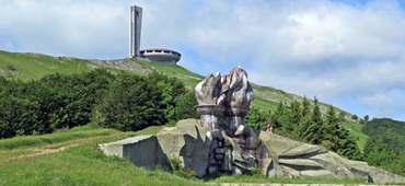
Can be combined with a visit to Kalofer Monastery, Shipka Pass, or Buzludzha Monument for a culture-nature combo tour.
Botev Peak via Rai Hut (Central Balkan)
- Level: Intermediate to Advanced
- Distance from Sofia: ~3 h drive to Kalofer trailhead
- Route Length: ~20 km
- Elevation Gain: ~1,300 m
- Hiking Time: 8–9 hours (or split into a 2-day hike)
- Best Months: June – September
- Map: View Trail
This is a challenging but rewarding trek to Bulgaria’s highest Balkan peak, Botev (2,376 m). The route passes through Rai Waterfall, the tallest in the Balkans, and continues through alpine pastures and rugged ridgelines.
Located in the Central Balkan National Park, this trail offers a fantastic mix of nature, biodiversity, and panoramic views. Overnight at Rai Hut for a two-day version, popular with private trekking groups.
Beklemeto Pass to Kozya Stena Ridge Trail
- Level: Easy to Intermediate
- Distance from Sofia: ~2.5 h drive
- Route Length: ~10 km (loop or one-way option)
- Elevation Gain: ~400 m
- Hiking Time: 4–5 hours
- Best Months: May – October
- Map: View Trail
Starting from the panoramic Beklemeto Pass, this hike follows a scenic ridge trail to the Kozya Stena Reserve, known for its wild goats, rare flowers, and views stretching across the Danube Plain. This is one of the easiest access points to the Central Balkan ridges and is perfect for less experienced hikers or private family tours.
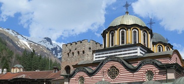
You can pair it with a visit to nearby Troyan Monastery or a wine tasting at local cellars.
⛰️ Vitosha Mountains – Sofia’s Backyard for Easy Day Hikes and Scenic Peaks

Just a short ride from Bulgaria’s capital, the Vitosha Mountains are a local favorite for hiking, picnicking, snowshoeing, and mountain biking. With well-marked eco-trails, panoramic ridgelines, and shaded forests, this compact range is ideal for day hikes, especially if you’re based in Sofia.
Vitosha is one of the oldest nature parks in the Balkans and features Cherni Vrah (2,290 m) — one of the highest peaks in Bulgaria. If you’re planning a private hiking tour in Bulgaria, Vitosha offers accessible adventures year-round, perfect for beginners and mixed-level groups.
Boyana Lake and Boyana Waterfall Loop
- Level: Easy
- Distance from Sofia: 30–40 min by car or public transport
- Route Length: 6.5 km
- Elevation Gain: 544 m
- Hiking Time: ~4 hours
- Best Months: Late May – October
- Map: View Trail
This is one of the best hiking trails near Sofia, especially for beginners or families. The path winds through beech forests to the charming Boyana Lake, and continues to the impressive Boyana Waterfall — the tallest in Vitosha.
Tip: Pair this hike with a visit to the UNESCO-listed Boyana Church, just minutes from the trailhead.
Momina Skala & Kamen Del Hut Loop
- Level: Intermediate
- Distance from Sofia: 30–40 min by car or public transport
- Route Length: 10 km
- Elevation Gain: 775 m
- Hiking Time: ~5.5–6 hours
- Best Months: Late May – October
- Map: View Trail
This lesser-known circular hike climbs through old-growth forest to the rocky ridge of Kamen Del (1,862 m), offering expansive views over Sofia and the Iskar Valley. It’s a peaceful alternative to the more popular Cherni Vrah route and ideal for small private groups who want a half-day escape from the city.
Cherni Vrah from Zheleznitsa (via Simeonovo Lift Exit)
- Level: Advanced
- Distance from Sofia: ~30 min drive to Zheleznitsa village
- Route Length: 12 km (one-way)
- Elevation Gain: 1,235 m
- Hiking Time: ~6.5–7 hours
- Best Months: June – October
- Map: View Trail
This challenging route takes you from Zheleznitsa village at the base of Vitosha to its highest summit — Cherni Vrah (2,290 m). You’ll hike through meadows, pass alpine huts, and conquer the open plateau for panoramic views across Rila, Pirin, and the Balkan Mountains.
Tip: You can descend by taking the Simeonovo chairlift, making it a rewarding point-to-point trek with less strain on the knees.
⛰️ Rhodope Mountains – Soft Trails, Deep Forests, and Mythic Landscapes
The Rhodope Mountains are Bulgaria’s greenest and most mystical range — home to legends of Orpheus, Thracian sanctuaries, and dense forests filled with waterfalls and meadows.
Spanning the southern border with Greece, the Rhodopes are known for their gentle slopes, traditional villages, and family-friendly ecotrails, making them ideal for beginners, photographers, and those looking to combine hiking with culture and spa experiences.
Whether you’re into short waterfall walks or half-day treks through ancient woodlands, the Rhodopes deliver unforgettable scenery and slow adventure, perfect for private hiking tours in Bulgaria.
Waterfalls Canyon Ecotrail (Smolyan Lakes)
- Level: Intermediate
- Distance from Sofia: ~3.5–4 h drive to Smolyan
- Route Length: 6 km
- Elevation Gain: 544 m
- Hiking Time: ~3.5–4 hours
- Best Months: May – October
- Map: View Trail
This iconic eco-trail in the Rhodopes follows the Elenska River, leading you past 40+ waterfalls, mossy bridges, and forested switchbacks. Wooden viewing platforms and shady picnic spots make it ideal for mixed-level groups or parents hiking with teens.
Tip: Stay in a mountain spa hotel in Smolyan — the perfect base for multiple-day hikes.
Rozhen Observatory to Momchilova Fortress Loop
- Level: Intermediate to Advanced
- Distance from Sofia: ~3.5 h drive to Rozhen
- Route Length: 20 km
- Elevation Gain: 844 m
- Hiking Time: ~7–8 hours
- Best Months: May – October
- Map: View Trail
This scenic trail begins at the Rozhen National Astronomical Observatory — one of the largest in Southeast Europe — and leads to the ruins of Momchilova Fortress, perched above cliffs and surrounded by pine forests. Ideal for those who love longer day hikes with historical landmarks.
Tip: On a clear night, the observatory offers night sky viewings, which pair beautifully with your daytime trekking.
Lednitsata Hut – Gradishte Fortress Trail (near Shiroka Laka)
- Level: Intermediate
- Distance from Sofia: ~180 km (~3.5 h drive)
- Route Length: ~11 km loop
- Elevation Gain: ~551 m
- Hiking Time: ~4–5 hours
- Best Months: May – October
- Map: View Trail
Starting in the traditional village of Shiroka Laka, this moderate trail leads to Gradishte Fortress, a scenic ridge with panoramic views over Rhodopian ridgelines and forest valleys. The path is quiet, surrounded by wildflowers in spring and golden forests in autumn — a favorite for slow hikers and nature photographers.
Tip: Visit the folklore museum in Shiroka Laka or enjoy a private bagpipe performance arranged by a local guide.
⛰️ Strandzha Mountains – Bulgaria’s Hidden Gem for Gentle Hiking & Eco-Trails
Tucked into the southeastern corner of Bulgaria, bordering Turkey and the Black Sea, the Strandzha Mountains offer something entirely different from the country’s high alpine peaks. These low, forested hills are part of the largest protected area in Bulgaria, Strandzha Nature Park, and are a haven for biodiversity, ancient Thracian sites, and authentic villages.
If you’re looking for tranquil, off-the-beaten-path hiking, eco-routes, and cultural encounters, Strandzha is your mountain.
This region is perfect for beginners, slow travelers, and families, with mild elevations and well-marked trails that often start and end in villages where time seems to stand still.
Tsarstvoto na Zelenikata Ecotrail (“The Kingdom of Greenery”)
- Level: Easy
- Distance from Sofia: 500 km, ~6.5 hours (best visited from Burgas or along a coastal tour)
- Route Length: ~4 km loop
- Elevation Gain: ~110 m
- Hiking Time: ~1.5 h
- Best Months: May – November
- Map: View Trail
One of the most popular educational and family trails in Strandzha Nature Park, this route is located near the village of Kondolovo and celebrates the region’s ancient oak and green beech forests. Along the way, you’ll find info boards, rare plant species, and views over Strandzha’s deep valleys.
Ideal for eco-tourists, birdwatchers, and botany lovers.
Balgari Village – Kosti Village Trail
- Level: Easy to Intermediate
- Distance from Sofia: ~480 km, ~6.5 hours (or 1 hour from Tsarevo on the coast)
- Route Length: ~16 km
- Elevation Gain: ~141 m gain / -396 m descent
- Hiking Time: 4.5–5 h
- Best Months: May – November
- Map: View Trail
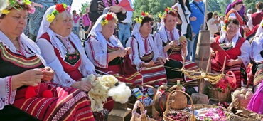
This linear trail connects two of Strandzha’s most culturally significant villages, both known for their fire-dancing (nestinari) traditions and preserved Thracian heritage. You’ll walk through gentle hills, oak forests, and meadows, discovering quiet, untouched Bulgaria.
Recommended as part of a guided day tour or slow-travel itinerary through the southeast.
Marina Reka Ecotrail
- Level: Easy
- Distance from Sofia: ~495 km, ~6.5 h drive (close to Malko Tarnovo)
- Route Length: ~3 km
- Elevation Gain: ~80 m
- Hiking Time: ~1 hour
- Best Months: May – November
- Map: View Trail
This short but rich trail showcases wetland ecosystems, rare amphibians, and lush greenery. It’s often used for educational walks with kids, nature photography, and relaxing forest bathing.
Best suited for families, casual walkers, and eco-minded travelers exploring Bulgaria’s wild southeast.
👉 Check also our guide: What to Know Before Visiting the Balkans: Local Tips for a Stress-Free Trip
🧳 Packing List
- Waterproof hiking shoes, especially for spring and early summer;
- Layers – mountain weather changes fast;
- Rain jacket;
- Offline maps or GPX files if going without a guide;
- Refillable water bottle (many fountains available);
- Trail snacks (local dried fruit and “kashkaval” cheese are great energy boosters);
🔒 Trail Safety, Gear & Local Customs
- Trail Markings: Red = main trails, Green = nature trails, Blue/Yellow = secondary routes.
- Shelters and Huts: Most mountain ranges feature mountain huts with basic food and beds.
- Mobile Coverage: Patchy. Download maps.me or Bulgarian Topo Maps in advance.
- Customs: Greet with “Zdraveĭte”, no littering, no loud music.
- Wildlife: Bears and wolves are rare—avoid startling them.
Safety Tips
- Register long hikes at hut stations
- Carry a charged phone and offline GPS apps
- Emergency number: 📞 112
Why Choose Bulgaria for Your Next Hiking Adventure?
✅ Uncrowded: Explore remote trails without the Alpine crowds;
✅ Affordable: Great value for guided or self-guided treks;
✅ Accessible: Many trails start near Sofia, Plovdiv, or resort towns;
✅ Authentic: Hike through landscapes steeped in folklore, Thracian ruins, and village life;
✅ Diverse: From glacial peaks to ancient forests to sea-view trails.
FAQs: Hiking in the Bulgarian Mountains
Which are the most beginner-friendly hikes in Bulgaria?
Some of the best hikes for beginners include:
- Boyana Waterfall near Sofia
- Waterfalls Canyon Ecotrail in the Rhodopes
- Tsarstvoto na Zelenikata Ecotrail in Strandzha
What is the hardest hiking trail in Bulgaria?
The Kom–Emine trail (part of the E3 European long-distance path) is the most challenging hike in Bulgaria, covering over 570 km across the Stara Planina range. It takes 18–21 days and is suited only for advanced trekkers.
Is Bulgaria safe for solo hiking?
Yes, many trails in Bulgaria are well-marked and maintained. However, for remote routes or multi-day treks, hiring a local guide can enhance your safety and experience, especially in the Pirin and Stara Planina ranges.
Are there family-friendly hiking trails in Bulgaria?
Yes! Trails like the 7 Rila Lakes, Boyana Waterfall, and Muratovo Lake are ideal for families.
Do I need a guide to hike in Bulgaria?
Not always, but a guide offers local context, off-the-map trails, safety insight, and flexible planning. Highly recommended for multi-day or high-altitude hikes.
Are there hiking trails close to Sofia?
Yes, the Vitosha Mountains offer several hiking options just 20–40 minutes from the city center, including Cherni Vrah, Boyana Waterfall, and Kamen Del.
Do I need special permits to hike in Bulgaria?
Is hiking in Bulgaria safe?
Bulgaria is considered a safe destination for hiking. Trails are generally well-marked, and local hospitality is strong. Always check the weather and be prepared for sudden changes in mountain conditions.
No permits are needed for most trails. However, some protected areas may have entrance fees or require you to stay on marked paths.